Thursday, December 3, 2020
U.S. Drought Monitor shows extreme drought conditions in watershed
Drought is a slow-moving disaster. It usually takes months for exceptional drought conditions to develop.
This year is no exception, as it has taken 18 months for Colorado to change from no drought to the entire state experiencing drought.
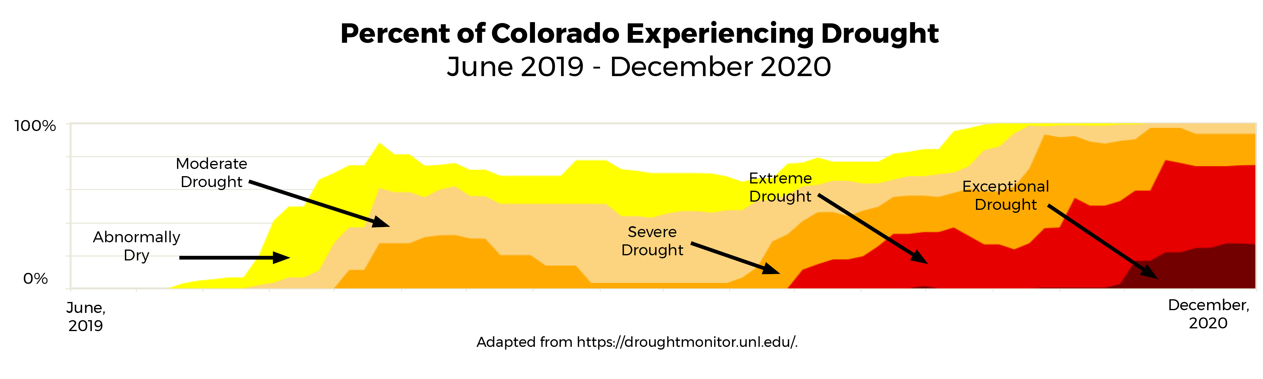
Click for larger version of graph
To ensure a reliable water supply, one tool the city uses is the U.S. Drought Monitor. This map is updated weekly by a team of scientists at the National Oceanic and Atmospheric Administration, the U.S. Department of Agriculture, and the National Drought Mitigation Center at the University of Nebraska-Lincoln.
A wide variety of data inputs are used to create the map, including measures of soil moisture, precipitation, vegetation health, climate data and snowpack. It's not a forecast map but rather a reflection of current drought conditions. The map shows a range from moderate drought (tan) to exceptional drought (dark red).
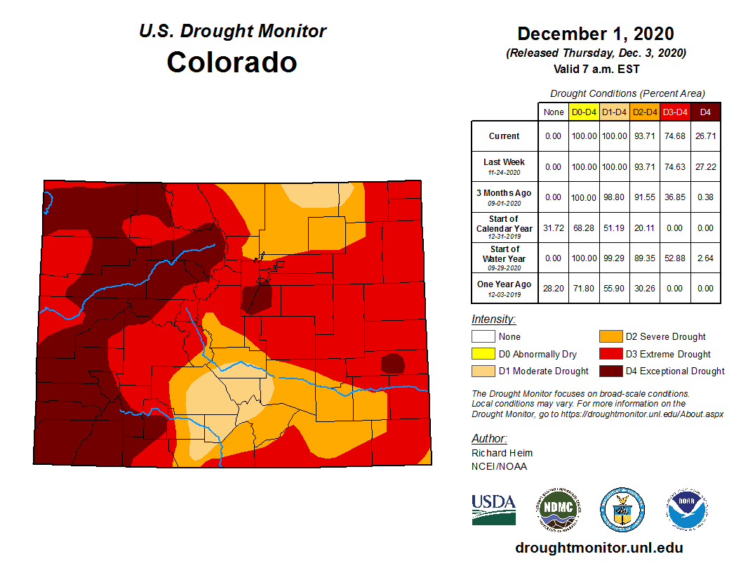
What does this mean for you? We're keeping a close eye on the situation. We are watching conditions both locally and in the Clear Creek watershed, where the majority of our drinking water originates. According to the Drought Monitor, both Westminster and our watershed are in extreme (red) or exceptional (dark red) drought categories.
These conditions don't yet equate to any drought declarations at this time due to adequate levels of reservoir water storage. The upcoming snow season may perpetuate or completely change the dry conditions, so let's all hope for a very snowy winter in the mountains! Stay tuned for continuing updates.